
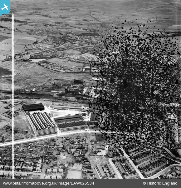
EAW025534 ENGLAND (1949). The Northrop Loom Works, Blackburn, from the north-west, 1949. This image has been produced from a damaged negative.
© Hawlfraint cyfranwyr OpenStreetMap a thrwyddedwyd gan yr OpenStreetMap Foundation. 2026. Trwyddedir y gartograffeg fel CC BY-SA.
Delweddau cyfagos (12)
EAW025534

EAW025538

EAW025526

EAW025539

EAW025533

EAW025527

EAW025537

EAW025536

EAW025535

EAW025532

EAW025540

EPW038980

Manylion
| Pennawd | [EAW025534] The Northrop Loom Works, Blackburn, from the north-west, 1949. This image has been produced from a damaged negative. |
| Cyfeirnod | EAW025534 |
| Dyddiad | 3-August-1949 |
| Dolen | |
| Enw lle | BLACKBURN |
| Plwyf | |
| Ardal | |
| Gwlad | ENGLAND |
| Dwyreiniad / Gogleddiad | 369655, 429083 |
| Hydred / Lledred | -2.4603019177563, 53.757003205004 |
| Cyfeirnod Grid Cenedlaethol | SD697291 |
Pinnau

redmist |
Friday 22nd of March 2019 09:19:29 AM | |
|
redmist |
Thursday 21st of March 2019 10:19:51 PM |