
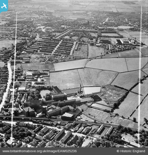
EAW025236 ENGLAND (1949). The Leigh Worsted Mills and the surrounding area, Pudsey, 1949. This image was marked by Aerofilms Ltd for photo editing.
© Hawlfraint cyfranwyr OpenStreetMap a thrwyddedwyd gan yr OpenStreetMap Foundation. 2026. Trwyddedir y gartograffeg fel CC BY-SA.
Delweddau cyfagos (19)
EAW025236

EAW025231

EAW025230

EAW025234

EAW025239

EAW031367

EAW031366

EAW025233

EAW031368

EAW031365

EAW031369

EAW031364

EPW023834

EAW025235

EAW031362

EAW031363

EAW025238

EAW025232

EPW034279

Manylion
| Pennawd | [EAW025236] The Leigh Worsted Mills and the surrounding area, Pudsey, 1949. This image was marked by Aerofilms Ltd for photo editing. |
| Cyfeirnod | EAW025236 |
| Dyddiad | 26-July-1949 |
| Dolen | |
| Enw lle | PUDSEY |
| Plwyf | |
| Ardal | |
| Gwlad | ENGLAND |
| Dwyreiniad / Gogleddiad | 421865, 434022 |
| Hydred / Lledred | -1.667977731282, 53.801824225433 |
| Cyfeirnod Grid Cenedlaethol | SE219340 |
