
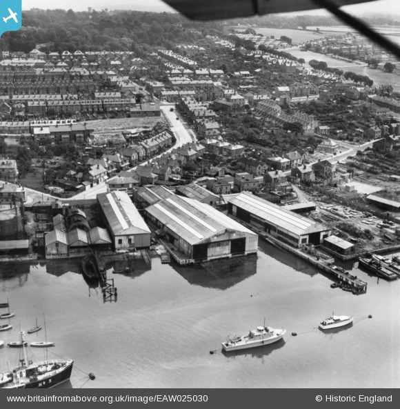
EAW025030 ENGLAND (1949). The Groves and Gutteridge Ltd Boatbuilding Yard, East Cowes, 1949. This image has been produced from a print.
© Hawlfraint cyfranwyr OpenStreetMap a thrwyddedwyd gan yr OpenStreetMap Foundation. 2026. Trwyddedir y gartograffeg fel CC BY-SA.
Delweddau cyfagos (10)
EAW025030

EAW025031

EAW025035

EAW025034

EAW025033

EAW025029

EAW025032

EPW022951

EAW015265

EAW022231

Manylion
| Pennawd | [EAW025030] The Groves and Gutteridge Ltd Boatbuilding Yard, East Cowes, 1949. This image has been produced from a print. |
| Cyfeirnod | EAW025030 |
| Dyddiad | 23-July-1949 |
| Dolen | |
| Enw lle | EAST COWES |
| Plwyf | EAST COWES |
| Ardal | |
| Gwlad | ENGLAND |
| Dwyreiniad / Gogleddiad | 450186, 95167 |
| Hydred / Lledred | -1.28848335599, 50.753359815747 |
| Cyfeirnod Grid Cenedlaethol | SZ502952 |
Pinnau

Sparky |
Saturday 9th of September 2017 08:58:42 AM |