
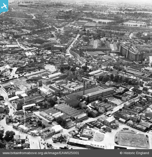
EAW025001 ENGLAND (1949). The Leigh Worsted Mill and the city centre, Coventry, from the north, 1949. This image has been produced from a print marked by Aerofilms Ltd for photo editing.
© Hawlfraint cyfranwyr OpenStreetMap a thrwyddedwyd gan yr OpenStreetMap Foundation. 2026. Trwyddedir y gartograffeg fel CC BY-SA.
Delweddau cyfagos (22)
EAW025001

EAW024989

EAW024998

EAW031596

EAW024993

EAW024990

EAW025000

EAW024992

EAW031592

EAW031595

EAW031597

EAW024994

EAW031593

EPW053110

EAW024997

EAW031594

EAW025002

EAW024999

EPW061105

EPW035765

EPW035764

EPW035762

Manylion
| Pennawd | [EAW025001] The Leigh Worsted Mill and the city centre, Coventry, from the north, 1949. This image has been produced from a print marked by Aerofilms Ltd for photo editing. |
| Cyfeirnod | EAW025001 |
| Dyddiad | 21-July-1949 |
| Dolen | |
| Enw lle | COVENTRY |
| Plwyf | |
| Ardal | |
| Gwlad | ENGLAND |
| Dwyreiniad / Gogleddiad | 433020, 279336 |
| Hydred / Lledred | -1.5145106538381, 52.410651168666 |
| Cyfeirnod Grid Cenedlaethol | SP330793 |
Pinnau

redmist |
Thursday 20th of December 2018 10:33:25 PM |