
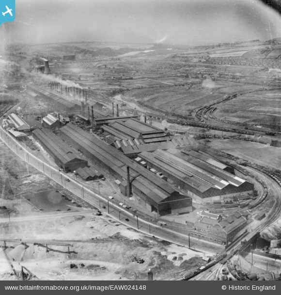
EAW024148 ENGLAND (1949). The Steel, Peech and Tozer Templeborough Steel Works, Templeborough, from the east, 1949. This image has been produced from a print.
© Hawlfraint cyfranwyr OpenStreetMap a thrwyddedwyd gan yr OpenStreetMap Foundation. 2026. Trwyddedir y gartograffeg fel CC BY-SA.
Delweddau cyfagos (10)
EAW024148

EAW024149

EAW024150

EAW029396

EAW029395

EAW030489

EAW029394

EAW024147

EAW030487

EPW048730

Manylion
| Pennawd | [EAW024148] The Steel, Peech and Tozer Templeborough Steel Works, Templeborough, from the east, 1949. This image has been produced from a print. |
| Cyfeirnod | EAW024148 |
| Dyddiad | 22-June-1949 |
| Dolen | |
| Enw lle | TEMPLEBOROUGH |
| Plwyf | |
| Ardal | |
| Gwlad | ENGLAND |
| Dwyreiniad / Gogleddiad | 441533, 391530 |
| Hydred / Lledred | -1.3749980423963, 53.418675426593 |
| Cyfeirnod Grid Cenedlaethol | SK415915 |
Pinnau
Byddwch y cyntaf i ychwanegu sylw at y ddelwedd hon!