
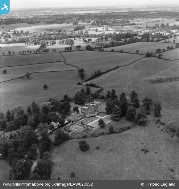
EAW023652 ENGLAND (1949). Hilfield Castle and surrounding countryside, Bushey, from the south, 1949. This image has been produced from a print.
© Hawlfraint cyfranwyr OpenStreetMap a thrwyddedwyd gan yr OpenStreetMap Foundation. 2026. Trwyddedir y gartograffeg fel CC BY-SA.
Delweddau cyfagos (11)
EAW023652

EAW023651

EAW048862

EAW023650

EAW023649

EAW023654

EAW023653

EAW045346

EAW045343

EAW045344

EAW045345

Manylion
| Pennawd | [EAW023652] Hilfield Castle and surrounding countryside, Bushey, from the south, 1949. This image has been produced from a print. |
| Cyfeirnod | EAW023652 |
| Dyddiad | 2-June-1949 |
| Dolen | |
| Enw lle | BUSHEY |
| Plwyf | |
| Ardal | |
| Gwlad | ENGLAND |
| Dwyreiniad / Gogleddiad | 515285, 196256 |
| Hydred / Lledred | -0.33334559770027, 51.652792510963 |
| Cyfeirnod Grid Cenedlaethol | TQ153963 |
Pinnau
Byddwch y cyntaf i ychwanegu sylw at y ddelwedd hon!