
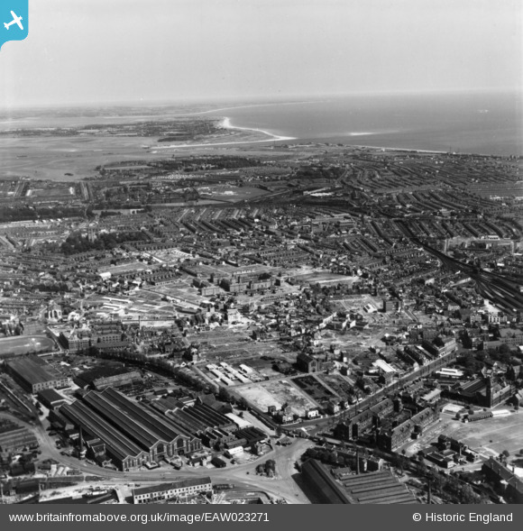
EAW023271 ENGLAND (1949). Cleared areas following bomb damage around Fratton and environs, Portsmouth, from the west, 1949. This image has been produced from a print.
© Hawlfraint cyfranwyr OpenStreetMap a thrwyddedwyd gan yr OpenStreetMap Foundation. 2026. Trwyddedir y gartograffeg fel CC BY-SA.
Delweddau cyfagos (2)
EAW023271

EAW037864

Manylion
| Pennawd | [EAW023271] Cleared areas following bomb damage around Fratton and environs, Portsmouth, from the west, 1949. This image has been produced from a print. |
| Cyfeirnod | EAW023271 |
| Dyddiad | 19-May-1949 |
| Dolen | |
| Enw lle | PORTSMOUTH |
| Plwyf | |
| Ardal | |
| Gwlad | ENGLAND |
| Dwyreiniad / Gogleddiad | 464088, 100732 |
| Hydred / Lledred | -1.0904398243651, 50.802034120574 |
| Cyfeirnod Grid Cenedlaethol | SU641007 |
Pinnau

Keith Palmer |
Thursday 23rd of April 2020 09:44:20 AM | |
|
gBr |
Saturday 11th of March 2017 03:49:59 PM | |
|
gBr |
Saturday 11th of March 2017 03:48:55 PM | |
|
gBr |
Saturday 11th of March 2017 03:46:53 PM | |
|
gBr |
Saturday 11th of March 2017 03:32:56 PM | |
|
gBr |
Saturday 11th of March 2017 03:24:53 PM | |
|
gBr |
Saturday 11th of March 2017 03:23:48 PM | |
|
gBr |
Saturday 11th of March 2017 03:21:32 PM |