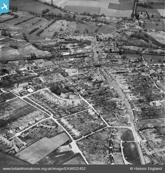
EAW022452 ENGLAND (1949). The town centre, Hungerford, 1949
© Hawlfraint cyfranwyr OpenStreetMap a thrwyddedwyd gan yr OpenStreetMap Foundation. 2026. Trwyddedir y gartograffeg fel CC BY-SA.
Manylion
| Pennawd | [EAW022452] The town centre, Hungerford, 1949 |
| Cyfeirnod | EAW022452 |
| Dyddiad | 22-April-1949 |
| Dolen | |
| Enw lle | HUNGERFORD |
| Plwyf | HUNGERFORD |
| Ardal | |
| Gwlad | ENGLAND |
| Dwyreiniad / Gogleddiad | 433672, 168475 |
| Hydred / Lledred | -1.5157668325164, 51.413799558392 |
| Cyfeirnod Grid Cenedlaethol | SU337685 |
Pinnau

Matt Aldred edob.mattaldred.com |
Thursday 8th of May 2025 02:30:00 PM | |

Matt Aldred edob.mattaldred.com |
Monday 30th of November 2020 09:54:14 PM | |

John W |
Friday 24th of March 2017 08:20:46 PM | |

John W |
Friday 24th of March 2017 08:14:52 PM | |

John W |
Friday 24th of March 2017 08:14:02 PM | |

John W |
Friday 24th of March 2017 08:01:04 PM | |

melgibbs |
Monday 21st of April 2014 04:53:23 PM | |

cptpies |
Tuesday 17th of December 2013 12:54:55 PM | |
On the north side of Hungerford lock on the Kennet and Avon Canal - the canal was to form a major line of resistance during WW2 should the Germans have invaded the country. |

John W |
Friday 24th of March 2017 08:17:03 PM |
Cyfraniadau Grŵp

cptpies |
Thursday 19th of December 2013 01:44:47 PM |


![[EAW022452] The town centre, Hungerford, 1949](http://britainfromabove.org.uk/sites/all/libraries/aerofilms-images/public/100x100/EAW/022/EAW022452.jpg)
![[EPW011136] Church Croft and the town, Hungerford, 1924. This image has been produced from a copy-negative.](http://britainfromabove.org.uk/sites/all/libraries/aerofilms-images/public/100x100/EPW/011/EPW011136.jpg)
