
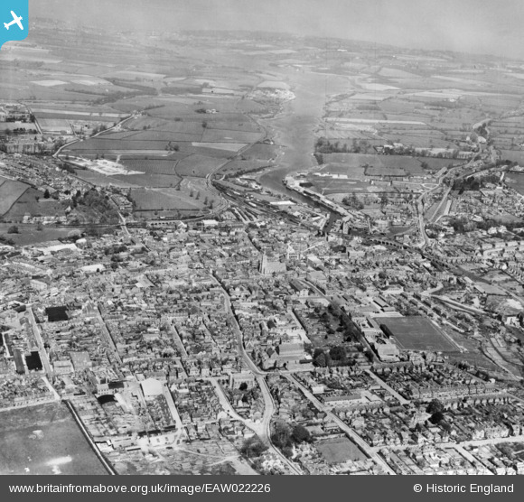
EAW022226 ENGLAND (1949). The town, Newport, from the south, 1949. This image has been produced from a copy-negative.
© Hawlfraint cyfranwyr OpenStreetMap a thrwyddedwyd gan yr OpenStreetMap Foundation. 2026. Trwyddedir y gartograffeg fel CC BY-SA.
Delweddau cyfagos (5)
EAW022226

EPW023024

EPW039657

EAW022227

EAW003000

Manylion
| Pennawd | [EAW022226] The town, Newport, from the south, 1949. This image has been produced from a copy-negative. |
| Cyfeirnod | EAW022226 |
| Dyddiad | 17-April-1949 |
| Dolen | |
| Enw lle | NEWPORT |
| Plwyf | NEWPORT |
| Ardal | |
| Gwlad | ENGLAND |
| Dwyreiniad / Gogleddiad | 449869, 88813 |
| Hydred / Lledred | -1.2938367439281, 50.696245516486 |
| Cyfeirnod Grid Cenedlaethol | SZ499888 |
Pinnau
Byddwch y cyntaf i ychwanegu sylw at y ddelwedd hon!