
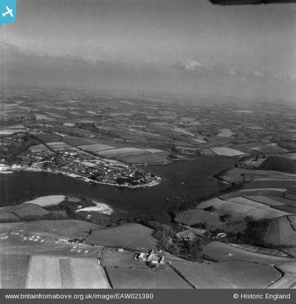
EAW021380 ENGLAND (1949). Polvarth Point and the Percuil River, St Mawes, from the south, 1949. This image has been produced from a print.
© Hawlfraint cyfranwyr OpenStreetMap a thrwyddedwyd gan yr OpenStreetMap Foundation. 2026. Trwyddedir y gartograffeg fel CC BY-SA.
Manylion
| Pennawd | [EAW021380] Polvarth Point and the Percuil River, St Mawes, from the south, 1949. This image has been produced from a print. |
| Cyfeirnod | EAW021380 |
| Dyddiad | 11-March-1949 |
| Dolen | |
| Enw lle | ST MAWES |
| Plwyf | ST. JUST-IN-ROSELAND |
| Ardal | |
| Gwlad | ENGLAND |
| Dwyreiniad / Gogleddiad | 185426, 32664 |
| Hydred / Lledred | -5.0042090094068, 50.154508433092 |
| Cyfeirnod Grid Cenedlaethol | SW854327 |
Pinnau

CornwallPhil |
Saturday 6th of September 2014 10:35:01 PM | |
|
CornwallPhil |
Saturday 6th of September 2014 10:33:58 PM | |
|
CornwallPhil |
Saturday 6th of September 2014 10:30:59 PM | |
|
CornwallPhil |
Saturday 6th of September 2014 10:30:17 PM |
Cyfraniadau Grŵp

Two of Falmouth's Heavy Anti Aircraft Batteries |
CornwallPhil |
Saturday 6th of September 2014 10:40:18 PM |