
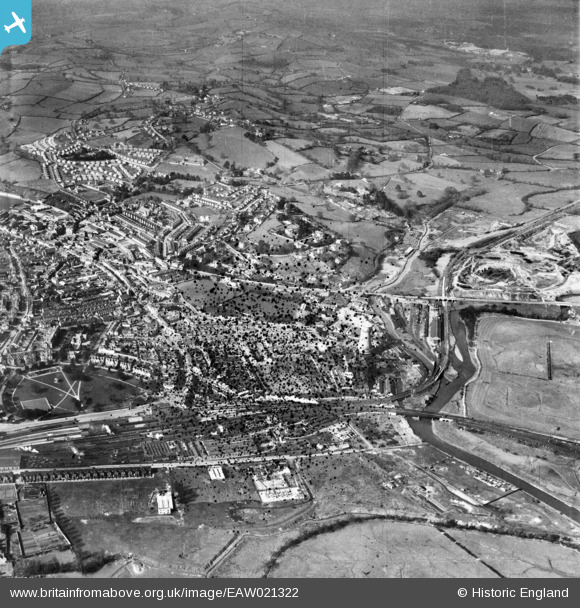
EAW021322 ENGLAND (1949). The railway station and town, Newton Abbot, from the east, 1949. This image has been produced from a damaged negative.
© Hawlfraint cyfranwyr OpenStreetMap a thrwyddedwyd gan yr OpenStreetMap Foundation. 2026. Trwyddedir y gartograffeg fel CC BY-SA.
Delweddau cyfagos (12)
EAW021322

EAW021326

EAW021318

EAW021319

EAW021327

EAW021320

EAW021325

EAW021324

EAW021317

EAW021321

EAW021323

EPW033398

Manylion
| Pennawd | [EAW021322] The railway station and town, Newton Abbot, from the east, 1949. This image has been produced from a damaged negative. |
| Cyfeirnod | EAW021322 |
| Dyddiad | 9-March-1949 |
| Dolen | |
| Enw lle | NEWTON ABBOT |
| Plwyf | NEWTON ABBOT |
| Ardal | |
| Gwlad | ENGLAND |
| Dwyreiniad / Gogleddiad | 286781, 71484 |
| Hydred / Lledred | -3.5976663190521, 50.53156838493 |
| Cyfeirnod Grid Cenedlaethol | SX868715 |
Pinnau

Class31 |
Friday 19th of February 2016 07:27:12 PM |
