
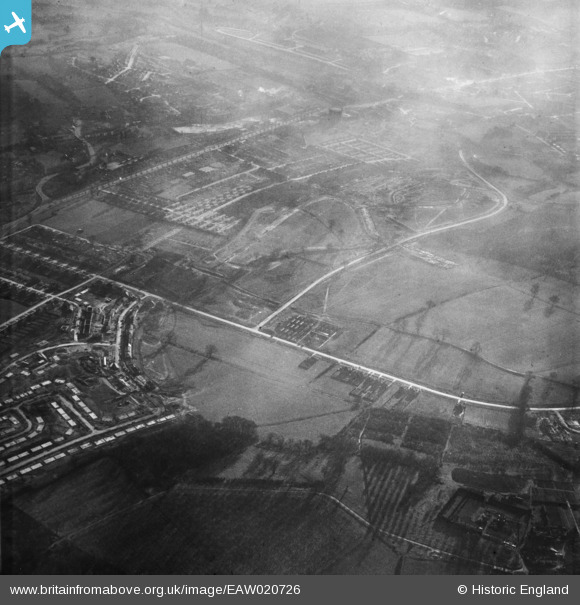
EAW020726 ENGLAND (1948). Midfield Way and nearby housing development, St Paul's Cray, 1948
© Hawlfraint cyfranwyr OpenStreetMap a thrwyddedwyd gan yr OpenStreetMap Foundation. 2026. Trwyddedir y gartograffeg fel CC BY-SA.
Delweddau cyfagos (2)
EAW020726

EAW026812

Manylion
| Pennawd | [EAW020726] Midfield Way and nearby housing development, St Paul's Cray, 1948 |
| Cyfeirnod | EAW020726 |
| Dyddiad | 24-December-1948 |
| Dolen | |
| Enw lle | ST PAUL'S CRAY |
| Plwyf | |
| Ardal | |
| Gwlad | ENGLAND |
| Dwyreiniad / Gogleddiad | 546488, 169716 |
| Hydred / Lledred | 0.10641534074284, 51.407029609224 |
| Cyfeirnod Grid Cenedlaethol | TQ465697 |
Pinnau
 |

Gone2Kent |
Sunday 8th of June 2014 09:41:17 AM |
|
Gone2Kent |
Sunday 9th of February 2014 01:52:28 PM | |
 |
Gone2Kent |
Sunday 26th of January 2014 09:36:13 AM |
