
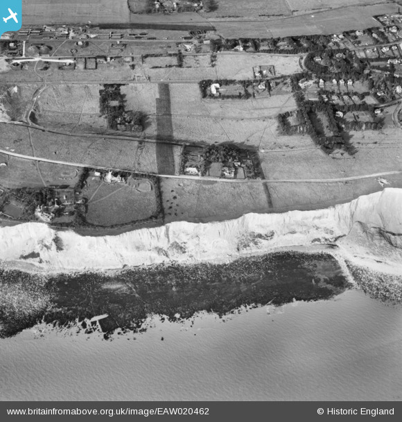
EAW020462 ENGLAND (1948). South Foreland Battery, the windmill and Whitecliff, St Margaret's at Cliffe, 1948
© Hawlfraint cyfranwyr OpenStreetMap a thrwyddedwyd gan yr OpenStreetMap Foundation. 2026. Trwyddedir y gartograffeg fel CC BY-SA.
Delweddau cyfagos (5)
EAW020462

EAW024840

EAW024835

EAW020463

EAW020461

Manylion
| Pennawd | [EAW020462] South Foreland Battery, the windmill and Whitecliff, St Margaret's at Cliffe, 1948 |
| Cyfeirnod | EAW020462 |
| Dyddiad | 9-November-1948 |
| Dolen | |
| Enw lle | ST MARGARET'S AT CLIFFE |
| Plwyf | ST. MARGARET'S AT CLIFFE |
| Ardal | |
| Gwlad | ENGLAND |
| Dwyreiniad / Gogleddiad | 636398, 143595 |
| Hydred / Lledred | 1.3800323108594, 51.142202756978 |
| Cyfeirnod Grid Cenedlaethol | TR364436 |
Pinnau

Matt Aldred edob.mattaldred.com |
Monday 30th of November 2020 08:47:01 PM | |
|
Matt Aldred edob.mattaldred.com |
Monday 30th of November 2020 08:45:03 PM |
Cyfraniadau Grŵp

South Foreland Battery. |

cptpies |
Thursday 19th of December 2013 02:29:34 PM |