
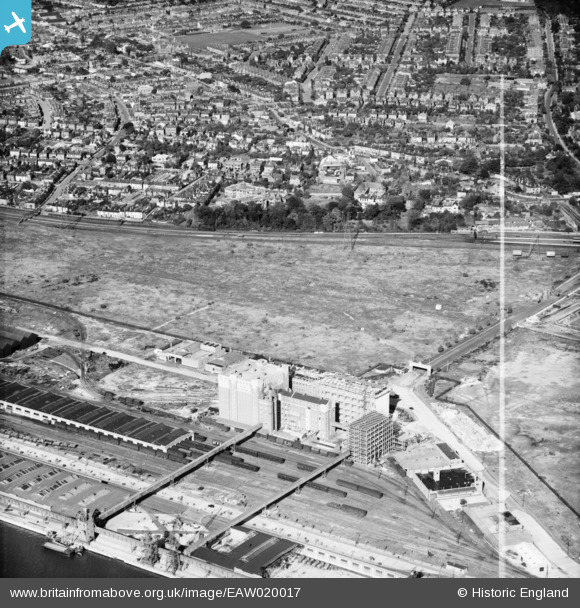
EAW020017 ENGLAND (1948). Construction work at J. Rank Ltd Solent Flour Mills and the Freemantle area, Southampton, 1948. This image was marked by Aerofilms Ltd for photo editing.
© Hawlfraint cyfranwyr OpenStreetMap a thrwyddedwyd gan yr OpenStreetMap Foundation. 2026. Trwyddedir y gartograffeg fel CC BY-SA.
Delweddau cyfagos (5)
EAW020017

EPW042957

EAW004212

EAW020014

EAW004213

Manylion
| Pennawd | [EAW020017] Construction work at J. Rank Ltd Solent Flour Mills and the Freemantle area, Southampton, 1948. This image was marked by Aerofilms Ltd for photo editing. |
| Cyfeirnod | EAW020017 |
| Dyddiad | 19-October-1948 |
| Dolen | |
| Enw lle | SOUTHAMPTON |
| Plwyf | |
| Ardal | |
| Gwlad | ENGLAND |
| Dwyreiniad / Gogleddiad | 440994, 112015 |
| Hydred / Lledred | -1.4169112455416, 50.905597365777 |
| Cyfeirnod Grid Cenedlaethol | SU410120 |
