
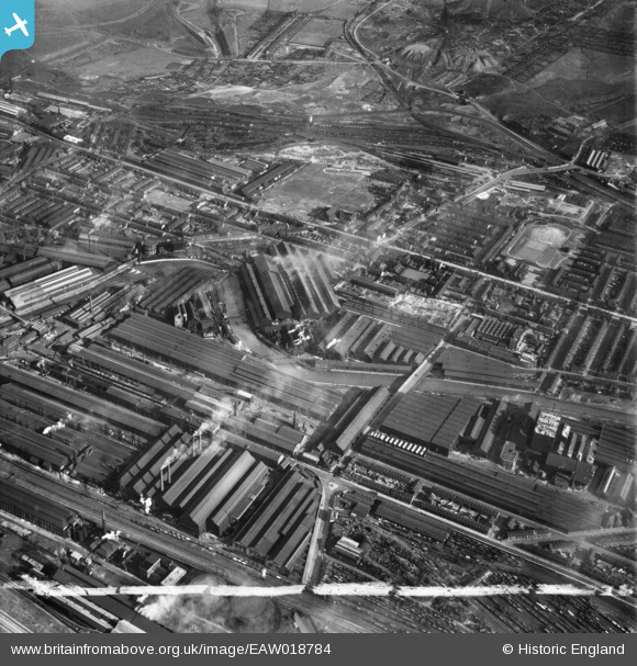
EAW018784 ENGLAND (1948). Brightside Sidings, the English Steel Corporation Ltd River Don Steel Works and environs, Brightside, 1948. This image was marked by Aerofilms Ltd for photo editing.
© Hawlfraint cyfranwyr OpenStreetMap a thrwyddedwyd gan yr OpenStreetMap Foundation. 2026. Trwyddedir y gartograffeg fel CC BY-SA.
Delweddau cyfagos (24)
EAW018784

EAW020061

EAW020054

EAW018785

EAW026019

EAW020060

EAW022027

EAW018783

EAW018782

EAW026010

EAW026015

EAW018781

EAW026009

EAW026013

EAW026014

EPW007785

EAW022026

EAW026021

EAW022025

EAW026012

EAW018786

EPW007788

EAW026020

EAW022024

Manylion
| Pennawd | [EAW018784] Brightside Sidings, the English Steel Corporation Ltd River Don Steel Works and environs, Brightside, 1948. This image was marked by Aerofilms Ltd for photo editing. |
| Cyfeirnod | EAW018784 |
| Dyddiad | 21-September-1948 |
| Dolen | |
| Enw lle | BRIGHTSIDE |
| Plwyf | |
| Ardal | |
| Gwlad | ENGLAND |
| Dwyreiniad / Gogleddiad | 438494, 389901 |
| Hydred / Lledred | -1.4209261550633, 53.404262671279 |
| Cyfeirnod Grid Cenedlaethol | SK385899 |

