
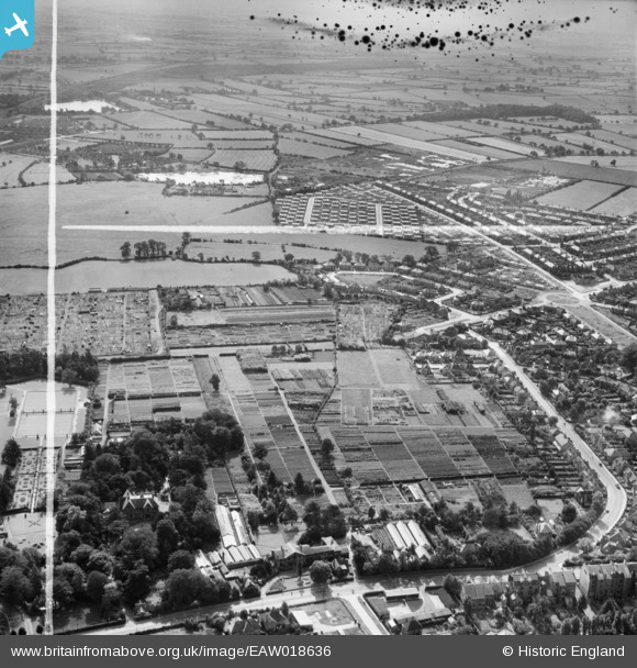
EAW018636 ENGLAND (1948). The Backhouse Nurseries and the surrounding area, Holgate, from the north, 1948. This image was marked by Aerofilms Ltd for photo editing.
© Hawlfraint cyfranwyr OpenStreetMap a thrwyddedwyd gan yr OpenStreetMap Foundation. 2026. Trwyddedir y gartograffeg fel CC BY-SA.
Delweddau cyfagos (6)
EAW018636

EAW018642

EAW018641

EAW018637

EAW018638
 and the surrounding area, Holgate, 1948. This image has been produced from a damaged negative.")
EAW018639

Manylion
| Pennawd | [EAW018636] The Backhouse Nurseries and the surrounding area, Holgate, from the north, 1948. This image was marked by Aerofilms Ltd for photo editing. |
| Cyfeirnod | EAW018636 |
| Dyddiad | 10-September-1948 |
| Dolen | |
| Enw lle | HOLGATE |
| Plwyf | |
| Ardal | |
| Gwlad | ENGLAND |
| Dwyreiniad / Gogleddiad | 458178, 451230 |
| Hydred / Lledred | -1.11334481422, 53.953692870989 |
| Cyfeirnod Grid Cenedlaethol | SE582512 |
Pinnau
Byddwch y cyntaf i ychwanegu sylw at y ddelwedd hon!