
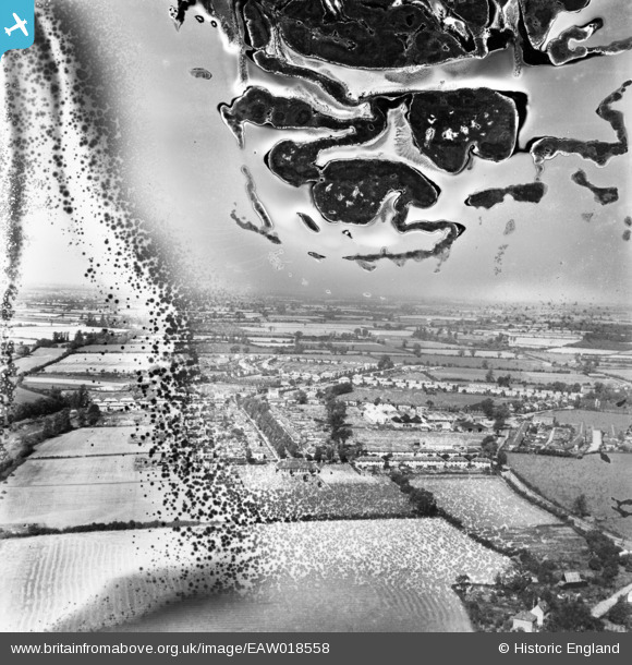
EAW018558 ENGLAND (1948). The village, Silver End, from the south-east, 1948. This image has been produced from a damaged negative.
© Hawlfraint cyfranwyr OpenStreetMap a thrwyddedwyd gan yr OpenStreetMap Foundation. 2026. Trwyddedir y gartograffeg fel CC BY-SA.
Delweddau cyfagos (4)
EAW018558

EAW018556

EAW018553

EPW022361

Manylion
| Pennawd | [EAW018558] The village, Silver End, from the south-east, 1948. This image has been produced from a damaged negative. |
| Cyfeirnod | EAW018558 |
| Dyddiad | 9-September-1948 |
| Dolen | |
| Enw lle | SILVER END |
| Plwyf | SILVER END |
| Ardal | |
| Gwlad | ENGLAND |
| Dwyreiniad / Gogleddiad | 581075, 219378 |
| Hydred / Lledred | 0.62892772856424, 51.843152594496 |
| Cyfeirnod Grid Cenedlaethol | TL811194 |
Pinnau

Stephen Mirrington |
Thursday 2nd of October 2025 04:57:36 PM |