
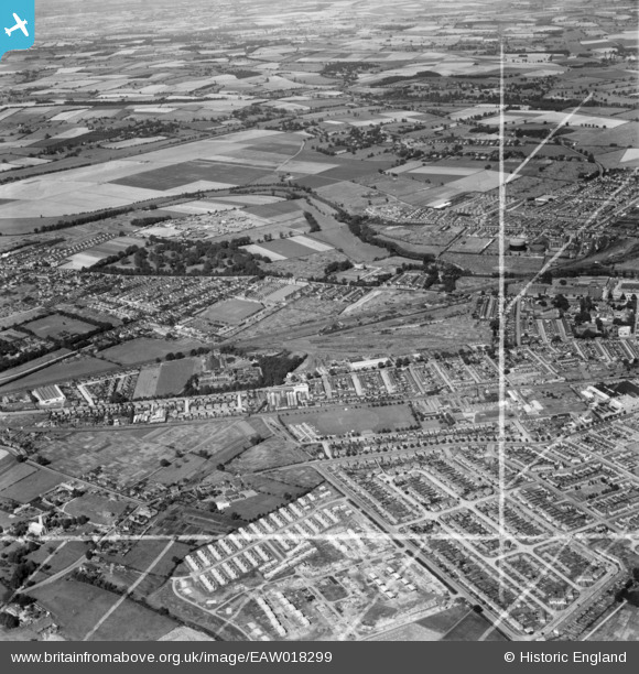
EAW018299 ENGLAND (1948). Residential areas around the Miller Road Recreation Ground and the Cosmic Crayon Works, South End, from the south-east, 1948. This image was marked by Aerofilms Ltd for photo editing.
© Hawlfraint cyfranwyr OpenStreetMap a thrwyddedwyd gan yr OpenStreetMap Foundation. 2026. Trwyddedir y gartograffeg fel CC BY-SA.
Delweddau cyfagos (6)
EAW018299

EAW021843

EAW018296

EAW021845

EAW018297

EAW021847

Manylion
| Pennawd | [EAW018299] Residential areas around the Miller Road Recreation Ground and the Cosmic Crayon Works, South End, from the south-east, 1948. This image was marked by Aerofilms Ltd for photo editing. |
| Cyfeirnod | EAW018299 |
| Dyddiad | 24-August-1948 |
| Dolen | |
| Enw lle | SOUTH END |
| Plwyf | |
| Ardal | |
| Gwlad | ENGLAND |
| Dwyreiniad / Gogleddiad | 504887, 247936 |
| Hydred / Lledred | -0.46789080367345, 52.119366690848 |
| Cyfeirnod Grid Cenedlaethol | TL049479 |
Pinnau
Byddwch y cyntaf i ychwanegu sylw at y ddelwedd hon!