
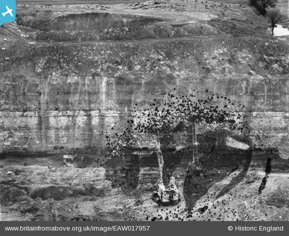
EAW017957 ENGLAND (1948). Opencast coal mining to the north of Carrington's Farm, Smalley, 1948. This image has been produced from a damaged negative.
© Hawlfraint cyfranwyr OpenStreetMap a thrwyddedwyd gan yr OpenStreetMap Foundation. 2026. Trwyddedir y gartograffeg fel CC BY-SA.
Delweddau cyfagos (14)
EAW017957

EAW017947

EAW017984

EAW017988

EAW017952

EAW017989

EAW017959

EAW017990

EAW017987

EAW011251

EAW011228

EAW011221

EAW012048

EAW011229

Manylion
| Pennawd | [EAW017957] Opencast coal mining to the north of Carrington's Farm, Smalley, 1948. This image has been produced from a damaged negative. |
| Cyfeirnod | EAW017957 |
| Dyddiad | 10-August-1948 |
| Dolen | |
| Enw lle | SMALLEY |
| Plwyf | SMALLEY |
| Ardal | |
| Gwlad | ENGLAND |
| Dwyreiniad / Gogleddiad | 441397, 346088 |
| Hydred / Lledred | -1.3829424920145, 53.010191340729 |
| Cyfeirnod Grid Cenedlaethol | SK414461 |
Pinnau
Byddwch y cyntaf i ychwanegu sylw at y ddelwedd hon!