
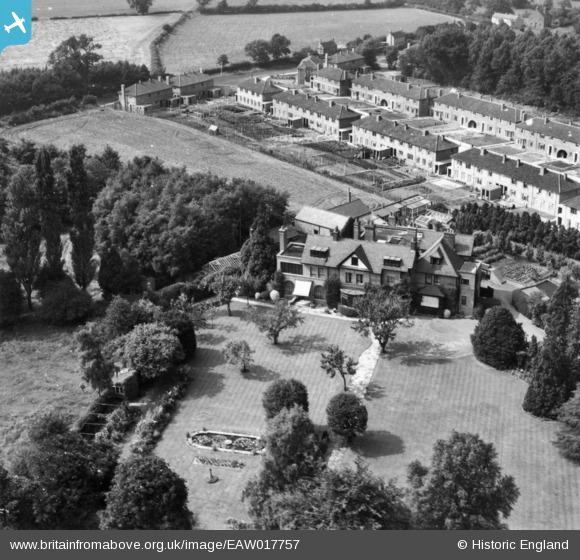
EAW017757 ENGLAND (1948). End Hall, Tettenhall Wood, 1948. This image has been produced from a print.
© Hawlfraint cyfranwyr OpenStreetMap a thrwyddedwyd gan yr OpenStreetMap Foundation. 2026. Trwyddedir y gartograffeg fel CC BY-SA.
Delweddau cyfagos (3)
EAW017757

EAW017758

EAW017756

Manylion
| Pennawd | [EAW017757] End Hall, Tettenhall Wood, 1948. This image has been produced from a print. |
| Cyfeirnod | EAW017757 |
| Dyddiad | 27-July-1948 |
| Dolen | |
| Enw lle | TETTENHALL WOOD |
| Plwyf | |
| Ardal | |
| Gwlad | ENGLAND |
| Dwyreiniad / Gogleddiad | 387479, 299253 |
| Hydred / Lledred | -2.1848474696257, 52.59057689181 |
| Cyfeirnod Grid Cenedlaethol | SO875993 |
