
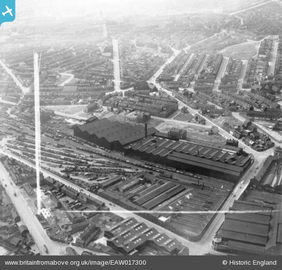
EAW017300 ENGLAND (1948). The Cyclops Steel and Iron Works and environs, Burngreave, 1948. This image has been produced from a print marked by Aerofilms Ltd for photo editing.
© Hawlfraint cyfranwyr OpenStreetMap a thrwyddedwyd gan yr OpenStreetMap Foundation. 2026. Trwyddedir y gartograffeg fel CC BY-SA.
Delweddau cyfagos (7)
EAW017300

EAW017303

EAW017304

EAW017301

EAW017305

EAW017302

EAW017299

Manylion
| Pennawd | [EAW017300] The Cyclops Steel and Iron Works and environs, Burngreave, 1948. This image has been produced from a print marked by Aerofilms Ltd for photo editing. |
| Cyfeirnod | EAW017300 |
| Dyddiad | 19-July-1948 |
| Dolen | |
| Enw lle | BURNGREAVE |
| Plwyf | |
| Ardal | |
| Gwlad | ENGLAND |
| Dwyreiniad / Gogleddiad | 436337, 388467 |
| Hydred / Lledred | -1.4535378880928, 53.391525080584 |
| Cyfeirnod Grid Cenedlaethol | SK363885 |
Pinnau

travellingpass |
Friday 19th of December 2014 12:53:52 PM | |
|
travellingpass |
Friday 19th of December 2014 12:52:04 PM |