
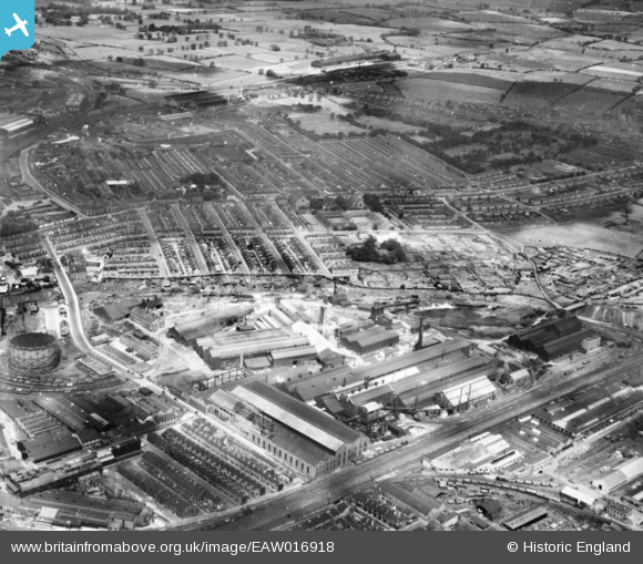
EAW016918 ENGLAND (1948). The Darlington Forge Ltd Works and the surrounding residential area, Darlington, 1948. This image has been produced from a print.
© Hawlfraint cyfranwyr OpenStreetMap a thrwyddedwyd gan yr OpenStreetMap Foundation. 2026. Trwyddedir y gartograffeg fel CC BY-SA.
Delweddau cyfagos (7)
EAW016918

EAW016914

EAW016920

EAW016917

EAW016911
 and environs, Darlington, 1948. This image has been produced from a damaged negative.")
EAW016915

EAW016913

Manylion
| Pennawd | [EAW016918] The Darlington Forge Ltd Works and the surrounding residential area, Darlington, 1948. This image has been produced from a print. |
| Cyfeirnod | EAW016918 |
| Dyddiad | 30-June-1948 |
| Dolen | |
| Enw lle | DARLINGTON |
| Plwyf | |
| Ardal | |
| Gwlad | ENGLAND |
| Dwyreiniad / Gogleddiad | 429334, 515965 |
| Hydred / Lledred | -1.5465801497257, 54.537975012548 |
| Cyfeirnod Grid Cenedlaethol | NZ293160 |
