
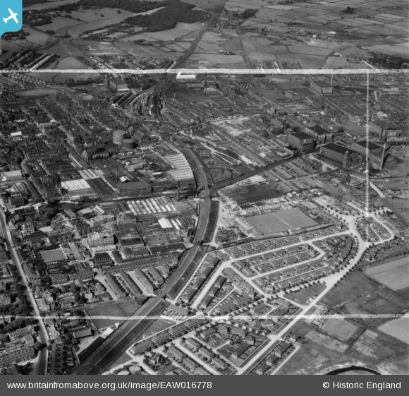
EAW016778 ENGLAND (1948). The Bedford Leigh railway embankment, the Anchor Electric Cable Works and environs, Leigh, 1948. This image was marked by Aerofilms Ltd for photo editing.
© Hawlfraint cyfranwyr OpenStreetMap a thrwyddedwyd gan yr OpenStreetMap Foundation. 2026. Trwyddedir y gartograffeg fel CC BY-SA.
Delweddau cyfagos (19)
EAW016778

EAW016780

EAW016784

EPW031119

EPW031125

EAW016783

EPW062124

EPW062119

EPW062121

EAW016786

EPW062123

EAW016779

EAW016777

EPW062125

EAW016781

EAW016776

EAW016785

EPW062120

EPW062118

Manylion
| Pennawd | [EAW016778] The Bedford Leigh railway embankment, the Anchor Electric Cable Works and environs, Leigh, 1948. This image was marked by Aerofilms Ltd for photo editing. |
| Cyfeirnod | EAW016778 |
| Dyddiad | 23-June-1948 |
| Dolen | |
| Enw lle | LEIGH |
| Plwyf | |
| Ardal | |
| Gwlad | ENGLAND |
| Dwyreiniad / Gogleddiad | 365943, 399689 |
| Hydred / Lledred | -2.5133900309421, 53.492553752021 |
| Cyfeirnod Grid Cenedlaethol | SJ659997 |
