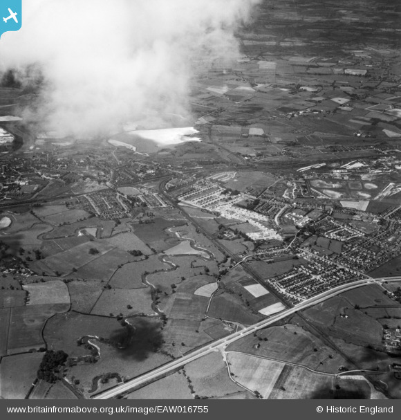
EAW016755 ENGLAND (1948). The River Dane looking towards the town centre, Northwich, from the south, 1948
© Hawlfraint cyfranwyr OpenStreetMap a thrwyddedwyd gan yr OpenStreetMap Foundation. 2026. Trwyddedir y gartograffeg fel CC BY-SA.
Manylion
| Pennawd | [EAW016755] The River Dane looking towards the town centre, Northwich, from the south, 1948 |
| Cyfeirnod | EAW016755 |
| Dyddiad | 23-June-1948 |
| Dolen | |
| Enw lle | NORTHWICH |
| Plwyf | NORTHWICH |
| Ardal | |
| Gwlad | ENGLAND |
| Dwyreiniad / Gogleddiad | 367073, 372686 |
| Hydred / Lledred | -2.4935427666579, 53.249887083826 |
| Cyfeirnod Grid Cenedlaethol | SJ671727 |
Pinnau

Bertmedia |
Friday 24th of March 2023 12:23:26 PM | |

Bertmedia |
Friday 24th of March 2023 12:16:30 PM | |

Bertmedia |
Friday 24th of March 2023 12:15:25 PM | |

Bertmedia |
Friday 24th of March 2023 12:14:14 PM | |

Bertmedia |
Friday 24th of March 2023 12:09:24 PM | |

Bertmedia |
Friday 24th of March 2023 12:05:12 PM | |

Bertmedia |
Friday 24th of March 2023 12:03:56 PM | |

Bertmedia |
Friday 24th of March 2023 12:02:49 PM | |

Bertmedia |
Friday 24th of March 2023 12:02:49 PM | |

slam13 |
Wednesday 22nd of October 2014 11:32:59 PM | |

slam13 |
Wednesday 22nd of October 2014 11:29:51 PM | |

slam13 |
Wednesday 22nd of October 2014 11:27:51 PM |


![[EAW016755] The River Dane looking towards the town centre, Northwich, from the south, 1948](http://britainfromabove.org.uk/sites/all/libraries/aerofilms-images/public/100x100/EAW/016/EAW016755.jpg)
![[EAW023495] The River Dane and town, Northwich, from the south-east, 1949](http://britainfromabove.org.uk/sites/all/libraries/aerofilms-images/public/100x100/EAW/023/EAW023495.jpg)