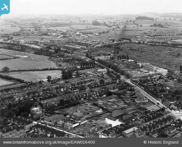
EAW016400 ENGLAND (1948). Sandon Road and environs, Stafford, from the south-west, 1948. This image has been produced from a print.
© Hawlfraint cyfranwyr OpenStreetMap a thrwyddedwyd gan yr OpenStreetMap Foundation. 2026. Trwyddedir y gartograffeg fel CC BY-SA.
Delweddau cyfagos (7)
Manylion
| Pennawd | [EAW016400] Sandon Road and environs, Stafford, from the south-west, 1948. This image has been produced from a print. |
| Cyfeirnod | EAW016400 |
| Dyddiad | 9-June-1948 |
| Dolen | |
| Enw lle | STAFFORD |
| Plwyf | |
| Ardal | |
| Gwlad | ENGLAND |
| Dwyreiniad / Gogleddiad | 392210, 324296 |
| Hydred / Lledred | -2.1155973130298, 52.815818142928 |
| Cyfeirnod Grid Cenedlaethol | SJ922243 |
Pinnau

Nothing Better To Do |
Wednesday 7th of June 2023 11:00:38 AM | |

Nothing Better To Do |
Wednesday 7th of June 2023 11:00:19 AM | |

Nothing Better To Do |
Wednesday 7th of June 2023 11:00:07 AM |


![[EAW016400] Sandon Road and environs, Stafford, from the south-west, 1948. This image has been produced from a print.](http://britainfromabove.org.uk/sites/all/libraries/aerofilms-images/public/100x100/EAW/016/EAW016400.jpg)
![[EAW016399] The Lotus Shoe Factory and environs, Stafford, from the north-west, 1948. This image has been produced from a print.](http://britainfromabove.org.uk/sites/all/libraries/aerofilms-images/public/100x100/EAW/016/EAW016399.jpg)
![[EPW034018] Marston Road Football Ground, the Lotus Shoe Factory and environs, Stafford, 1930](http://britainfromabove.org.uk/sites/all/libraries/aerofilms-images/public/100x100/EPW/034/EPW034018.jpg)
![[EAW016397] The Lotus Shoe Factory and environs, Stafford, from the north-west, 1948. This image has been produced from a print.](http://britainfromabove.org.uk/sites/all/libraries/aerofilms-images/public/100x100/EAW/016/EAW016397.jpg)
![[EPW053372] The Lotus Shoe Factory, Sandon Road and the surrounding residential area, Stafford, 1937](http://britainfromabove.org.uk/sites/all/libraries/aerofilms-images/public/100x100/EPW/053/EPW053372.jpg)
![[EAW016405] The Lotus Shoe Factory and environs, Stafford, 1948. This image has been produced from a print marked by Aerofilms Ltd for photo editing.](http://britainfromabove.org.uk/sites/all/libraries/aerofilms-images/public/100x100/EAW/016/EAW016405.jpg)
![[EAW016404] The Lotus Shoe Factory and environs, Stafford, 1948. This image has been produced from a print marked by Aerofilms Ltd for photo editing.](http://britainfromabove.org.uk/sites/all/libraries/aerofilms-images/public/100x100/EAW/016/EAW016404.jpg)