
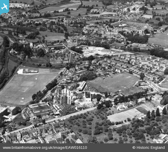
EAW016110 ENGLAND (1948). The Lightpill Iron Works, Dudbridge Road and environs, Lightpill, 1948. This image has been produced from a print.
© Hawlfraint cyfranwyr OpenStreetMap a thrwyddedwyd gan yr OpenStreetMap Foundation. 2026. Trwyddedir y gartograffeg fel CC BY-SA.
Delweddau cyfagos (10)
EAW016110

EAW016114

EAW016109

EAW016112

EPW041881

EAW016116

EAW016115
, Lightpill, from the north-east, 1948. This image has been produced from a damaged negative.")
EAW016111

EAW016113

EPW041882

Manylion
| Pennawd | [EAW016110] The Lightpill Iron Works, Dudbridge Road and environs, Lightpill, 1948. This image has been produced from a print. |
| Cyfeirnod | EAW016110 |
| Dyddiad | 21-May-1948 |
| Dolen | |
| Enw lle | LIGHTPILL |
| Plwyf | RODBOROUGH |
| Ardal | |
| Gwlad | ENGLAND |
| Dwyreiniad / Gogleddiad | 383848, 204427 |
| Hydred / Lledred | -2.2339373291743, 51.737861337411 |
| Cyfeirnod Grid Cenedlaethol | SO838044 |
Pinnau

Lyndon Smith |
Tuesday 16th of December 2025 10:44:51 PM | |
|
Robert |
Sunday 20th of February 2022 12:29:09 PM | |
|
Robert |
Sunday 20th of February 2022 12:27:53 PM | |
|
Robert |
Saturday 19th of February 2022 11:34:55 PM | |
|
Robert |
Saturday 19th of February 2022 11:32:48 PM |