
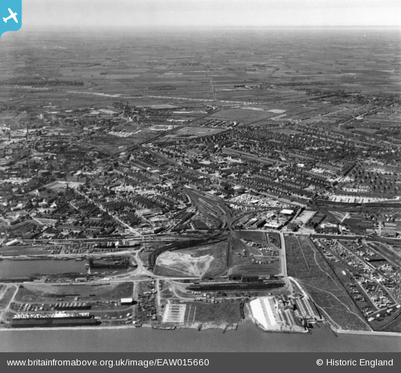
EAW015660 ENGLAND (1948). Timber Yards east of Victoria Dock and the Summergangs area, Kingston upon Hull, from the south, 1948. This image has been produced from a print.
© Hawlfraint cyfranwyr OpenStreetMap a thrwyddedwyd gan yr OpenStreetMap Foundation. 2026. Trwyddedir y gartograffeg fel CC BY-SA.
Delweddau cyfagos (6)
EAW015660

EAW015639

EAW018587

EPW010815

EPW062607

EPW055035

Manylion
| Pennawd | [EAW015660] Timber Yards east of Victoria Dock and the Summergangs area, Kingston upon Hull, from the south, 1948. This image has been produced from a print. |
| Cyfeirnod | EAW015660 |
| Dyddiad | 18-May-1948 |
| Dolen | |
| Enw lle | KINGSTON UPON HULL |
| Plwyf | |
| Ardal | |
| Gwlad | ENGLAND |
| Dwyreiniad / Gogleddiad | 511332, 428985 |
| Hydred / Lledred | -0.31161892492539, 53.745114003345 |
| Cyfeirnod Grid Cenedlaethol | TA113290 |
Pinnau

ladyceecee |
Friday 8th of February 2019 09:18:15 PM | |
|
ladyceecee |
Friday 8th of February 2019 09:17:18 PM | |
|
ladyceecee |
Sunday 27th of January 2019 07:27:16 PM | |
|
ladyceecee |
Sunday 27th of January 2019 07:23:44 PM |