
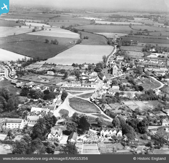
EAW015356 ENGLAND (1948). The village, Finchingfield, from the west, 1948. This image has been produced from a print.
© Hawlfraint cyfranwyr OpenStreetMap a thrwyddedwyd gan yr OpenStreetMap Foundation. 2026. Trwyddedir y gartograffeg fel CC BY-SA.
Delweddau cyfagos (2)
EAW015356

EAW015357

Manylion
| Pennawd | [EAW015356] The village, Finchingfield, from the west, 1948. This image has been produced from a print. |
| Cyfeirnod | EAW015356 |
| Dyddiad | 7-May-1948 |
| Dolen | |
| Enw lle | FINCHINGFIELD |
| Plwyf | FINCHINGFIELD |
| Ardal | |
| Gwlad | ENGLAND |
| Dwyreiniad / Gogleddiad | 568424, 232796 |
| Hydred / Lledred | 0.45200153258301, 51.967655259837 |
| Cyfeirnod Grid Cenedlaethol | TL684328 |

