
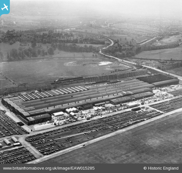
EAW015285 ENGLAND (1948). The British Industries Fair Exhibition Centre, Castle Vale, from the north, 1948. This image has been produced from a print.
© Hawlfraint cyfranwyr OpenStreetMap a thrwyddedwyd gan yr OpenStreetMap Foundation. 2026. Trwyddedir y gartograffeg fel CC BY-SA.
Delweddau cyfagos (19)
EAW015285

EAW015282

EAW015281

EPW054850

EAW014404

EAW015276

EAW015279

EAW014402
, Castle Vale, 1948. This image has been produced from a damaged negative.")
EPW042881

EAW043036

EPW042880

EAW015277

EAW043039

EPW042879

EPW054851

EAW014403

EAW015286

EAW014405

EAW015278

Manylion
| Pennawd | [EAW015285] The British Industries Fair Exhibition Centre, Castle Vale, from the north, 1948. This image has been produced from a print. |
| Cyfeirnod | EAW015285 |
| Dyddiad | 7-May-1948 |
| Dolen | |
| Enw lle | CASTLE VALE |
| Plwyf | |
| Ardal | |
| Gwlad | ENGLAND |
| Dwyreiniad / Gogleddiad | 414224, 290783 |
| Hydred / Lledred | -1.7903745241441, 52.514382597168 |
| Cyfeirnod Grid Cenedlaethol | SP142908 |
Pinnau
Byddwch y cyntaf i ychwanegu sylw at y ddelwedd hon!