
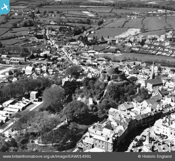
EAW014991 ENGLAND (1948). Launceston Castle above the town, Launceston, 1948. This image has been produced from a print.
© Hawlfraint cyfranwyr OpenStreetMap a thrwyddedwyd gan yr OpenStreetMap Foundation. 2026. Trwyddedir y gartograffeg fel CC BY-SA.
Delweddau cyfagos (19)
EAW014991

EPW054781

EAW005834

EAW005836

EAW005837

EAW005838

EAW005835

EAW014993

EPW023643

EPW054782

EAW014992

EPW023648

EPW023649

EPW023650

EPW023644

EPW054779

EPW023647

EPW054780

EPW011305

Manylion
| Pennawd | [EAW014991] Launceston Castle above the town, Launceston, 1948. This image has been produced from a print. |
| Cyfeirnod | EAW014991 |
| Dyddiad | 27-April-1948 |
| Dolen | |
| Enw lle | LAUNCESTON |
| Plwyf | LAUNCESTON |
| Ardal | |
| Gwlad | ENGLAND |
| Dwyreiniad / Gogleddiad | 233039, 84704 |
| Hydred / Lledred | -4.3613987645882, 50.637498447206 |
| Cyfeirnod Grid Cenedlaethol | SX330847 |
Pinnau

CornwallPhil |
Saturday 6th of September 2014 09:34:23 PM |