
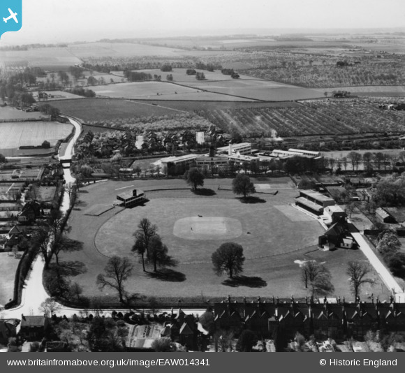
EAW014341 ENGLAND (1948). The Kent County Cricket Ground (St Lawrence Ground), Canterbury, from the north-east, 1948. This image has been produced from a print.
© Hawlfraint cyfranwyr OpenStreetMap a thrwyddedwyd gan yr OpenStreetMap Foundation. 2026. Trwyddedir y gartograffeg fel CC BY-SA.
Delweddau cyfagos (13)
EAW014341
, Canterbury, from the north-east, 1948. This image has been produced from a print.")
EPW038145

EPW018610
, Canterbury, 1927")
EPW018613
, Canterbury, 1927")
EAW014337
, Canterbury, 1948. This image has been produced from a print.")
EPW018614
, Canterbury, 1927")
EAW031806

EAW014339
, Canterbury, 1948. This image has been produced from a print.")
EPW018611
, Canterbury, 1927")
EAW031805

EAW014340
, Canterbury, from the south-east, 1948. This image has been produced from a print.")
EAW031807

EAW014338
, Canterbury, 1948. This image has been produced from a print.")
Manylion
| Pennawd | [EAW014341] The Kent County Cricket Ground (St Lawrence Ground), Canterbury, from the north-east, 1948. This image has been produced from a print. |
| Cyfeirnod | EAW014341 |
| Dyddiad | 13-April-1948 |
| Dolen | |
| Enw lle | CANTERBURY |
| Plwyf | |
| Ardal | |
| Gwlad | ENGLAND |
| Dwyreiniad / Gogleddiad | 615839, 156637 |
| Hydred / Lledred | 1.0944036248061, 51.267438963582 |
| Cyfeirnod Grid Cenedlaethol | TR158566 |
