
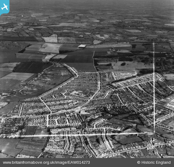
EAW014273 ENGLAND (1948). Clockhouse Lane and the development of Havering Park, Collier Row, from the south, 1948. This image has been produced from a print marked by Aerofilms Ltd for photo-editing.
© Hawlfraint cyfranwyr OpenStreetMap a thrwyddedwyd gan yr OpenStreetMap Foundation. 2026. Trwyddedir y gartograffeg fel CC BY-SA.
Delweddau cyfagos (2)
EAW014273

EAW014270

Manylion
| Pennawd | [EAW014273] Clockhouse Lane and the development of Havering Park, Collier Row, from the south, 1948. This image has been produced from a print marked by Aerofilms Ltd for photo-editing. |
| Cyfeirnod | EAW014273 |
| Dyddiad | 12-April-1948 |
| Dolen | |
| Enw lle | COLLIER ROW |
| Plwyf | |
| Ardal | |
| Gwlad | ENGLAND |
| Dwyreiniad / Gogleddiad | 549990, 191275 |
| Hydred / Lledred | 0.16590311819031, 51.59984540704 |
| Cyfeirnod Grid Cenedlaethol | TQ500913 |
Pinnau
Byddwch y cyntaf i ychwanegu sylw at y ddelwedd hon!