
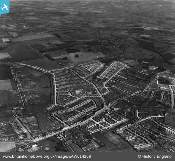
EAW014268 ENGLAND (1948). Clockhouse Lane and the development of Havering Park, Collier Row, 1948. This image has been produced from a print.
© Hawlfraint cyfranwyr OpenStreetMap a thrwyddedwyd gan yr OpenStreetMap Foundation. 2026. Trwyddedir y gartograffeg fel CC BY-SA.
Delweddau cyfagos (4)
EAW014268

EAW014267

EAW014269

EAW014272

Manylion
| Pennawd | [EAW014268] Clockhouse Lane and the development of Havering Park, Collier Row, 1948. This image has been produced from a print. |
| Cyfeirnod | EAW014268 |
| Dyddiad | 12-April-1948 |
| Dolen | |
| Enw lle | COLLIER ROW |
| Plwyf | |
| Ardal | |
| Gwlad | ENGLAND |
| Dwyreiniad / Gogleddiad | 550133, 191890 |
| Hydred / Lledred | 0.16822980361571, 51.605333634757 |
| Cyfeirnod Grid Cenedlaethol | TQ501919 |
