
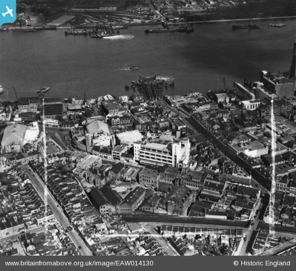
EAW014130 ENGLAND (1948). The Royal Arsenal Co-operative Society Central Premises on Powis Street and environs, Woolwich, 1948. This image has been produced from a print marked by Aerofilms Ltd for photo-editing.
© Hawlfraint cyfranwyr OpenStreetMap a thrwyddedwyd gan yr OpenStreetMap Foundation. 2026. Trwyddedir y gartograffeg fel CC BY-SA.
Delweddau cyfagos (12)
EAW014130

EAW014128

EAW014129

EAW014127

EAW014126

EPW008557

EAW014132

EAW014125

EAW014131

EAW037697

EAW037700

EAW037695

Manylion
| Pennawd | [EAW014130] The Royal Arsenal Co-operative Society Central Premises on Powis Street and environs, Woolwich, 1948. This image has been produced from a print marked by Aerofilms Ltd for photo-editing. |
| Cyfeirnod | EAW014130 |
| Dyddiad | 5-April-1948 |
| Dolen | |
| Enw lle | WOOLWICH |
| Plwyf | |
| Ardal | |
| Gwlad | ENGLAND |
| Dwyreiniad / Gogleddiad | 543304, 179194 |
| Hydred / Lledred | 0.064503004149229, 51.493019671864 |
| Cyfeirnod Grid Cenedlaethol | TQ433792 |
Pinnau

Jake |
Wednesday 20th of January 2021 05:04:54 PM | |
|
Nowy Paul |
Saturday 9th of December 2017 03:19:56 PM | |
|
John W |
Tuesday 3rd of May 2016 08:31:01 PM | |
|
John W |
Tuesday 3rd of May 2016 08:29:30 PM | |
|
John W |
Tuesday 3rd of May 2016 08:27:45 PM | |
|
John W |
Tuesday 3rd of May 2016 08:26:49 PM | |
|
John Wass |
Tuesday 28th of July 2015 07:58:35 PM |