
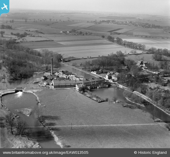
EAW013505 ENGLAND (1948). St Neots Paper Mills, Little Paxton, from the east, 1948. This image was marked by Aerofilms Ltd for photo editing.
© Hawlfraint cyfranwyr OpenStreetMap a thrwyddedwyd gan yr OpenStreetMap Foundation. 2026. Trwyddedir y gartograffeg fel CC BY-SA.
Delweddau cyfagos (16)
EAW013505

EAW013509

EAW013498

EAW013501

EAW013504

EAW013497

EAW013510

EAW013511

EAW013500

EAW013508

EAW013503

EAW013499

EAW013507

EAW013506

EAW003730

EAW013502

Manylion
| Pennawd | [EAW013505] St Neots Paper Mills, Little Paxton, from the east, 1948. This image was marked by Aerofilms Ltd for photo editing. |
| Cyfeirnod | EAW013505 |
| Dyddiad | 9-March-1948 |
| Dolen | |
| Enw lle | LITTLE PAXTON |
| Plwyf | LITTLE PAXTON |
| Ardal | |
| Gwlad | ENGLAND |
| Dwyreiniad / Gogleddiad | 518743, 261892 |
| Hydred / Lledred | -0.26070021916747, 52.241991187389 |
| Cyfeirnod Grid Cenedlaethol | TL187619 |
Pinnau

melgibbs |
Saturday 15th of February 2014 06:07:41 PM |