
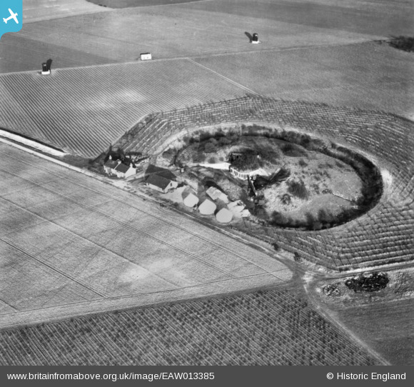
EAW013385 ENGLAND (1948). Fort Farningham, Farningham, 1948. This image has been produced from a print.
© Hawlfraint cyfranwyr OpenStreetMap a thrwyddedwyd gan yr OpenStreetMap Foundation. 2026. Trwyddedir y gartograffeg fel CC BY-SA.
Delweddau cyfagos (5)
EAW013385

EAW013381

EAW013384

EAW013382

EAW013383

Manylion
| Pennawd | [EAW013385] Fort Farningham, Farningham, 1948. This image has been produced from a print. |
| Cyfeirnod | EAW013385 |
| Dyddiad | 16-February-1948 |
| Dolen | |
| Enw lle | FARNINGHAM |
| Plwyf | FARNINGHAM |
| Ardal | |
| Gwlad | ENGLAND |
| Dwyreiniad / Gogleddiad | 553270, 166912 |
| Hydred / Lledred | 0.2026500374475, 51.380040257413 |
| Cyfeirnod Grid Cenedlaethol | TQ533669 |
Pinnau
Cyfraniadau Grŵp

A Couple of HFDF towers near Farningham Fort |

cptpies |
Tuesday 31st of March 2015 10:58:00 AM |