
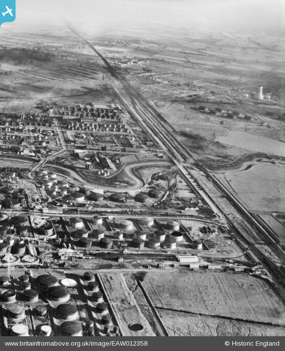
EAW012358 ENGLAND (1947). The Stanlow Oil Refinery, Ellesmere Port, from the north-west, 1947
© Hawlfraint cyfranwyr OpenStreetMap a thrwyddedwyd gan yr OpenStreetMap Foundation. 2026. Trwyddedir y gartograffeg fel CC BY-SA.
Delweddau cyfagos (13)
EAW012358

EAW012360

EAW012350A

EAW008706

EPW018812

EPW018811

EAW008705

EAW008711

EPW018808

EPW027976

EPW018813

EPW037730

EPW018807

Manylion
| Pennawd | [EAW012358] The Stanlow Oil Refinery, Ellesmere Port, from the north-west, 1947 |
| Cyfeirnod | EAW012358 |
| Dyddiad | 26-November-1947 |
| Dolen | |
| Enw lle | ELLESMERE PORT |
| Plwyf | |
| Ardal | |
| Gwlad | ENGLAND |
| Dwyreiniad / Gogleddiad | 342513, 376519 |
| Hydred / Lledred | -2.8623296390778, 53.282249060253 |
| Cyfeirnod Grid Cenedlaethol | SJ425765 |
Pinnau

redmist |
Saturday 5th of October 2019 10:48:29 PM | |
|
redmist |
Saturday 5th of October 2019 10:47:02 PM | |

Sparky |
Saturday 30th of September 2017 12:48:55 AM |