
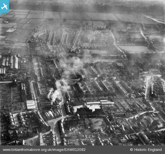
EAW012082 ENGLAND (1947). The Beeston County Secondary Girls School (John Clifford School) and the surrounding residential area, Rylands, 1947
© Hawlfraint cyfranwyr OpenStreetMap a thrwyddedwyd gan yr OpenStreetMap Foundation. 2026. Trwyddedir y gartograffeg fel CC BY-SA.
Delweddau cyfagos (2)
EAW012082
 and the surrounding residential area, Rylands, 1947")
EAW012083

Manylion
| Pennawd | [EAW012082] The Beeston County Secondary Girls School (John Clifford School) and the surrounding residential area, Rylands, 1947 |
| Cyfeirnod | EAW012082 |
| Dyddiad | 5-November-1947 |
| Dolen | |
| Enw lle | RYLANDS |
| Plwyf | |
| Ardal | |
| Gwlad | ENGLAND |
| Dwyreiniad / Gogleddiad | 453396, 336580 |
| Hydred / Lledred | -1.2056723075989, 52.923657718623 |
| Cyfeirnod Grid Cenedlaethol | SK534366 |
