
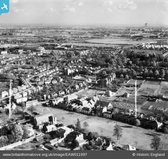
EAW011997 ENGLAND (1947). The town, West Drayton, from the west, 1947. This image was marked by Aerofilms Ltd for photo editing.
© Hawlfraint cyfranwyr OpenStreetMap a thrwyddedwyd gan yr OpenStreetMap Foundation. 2026. Trwyddedir y gartograffeg fel CC BY-SA.
Delweddau cyfagos (7)
EAW011997

EAW012001
 and environs, West Drayton, 1947. This image was marked by Aerofilms Ltd for photo editing.")
EAW011998
 and environs, West Drayton, 1947")
EAW012000
 and The Green, West Drayton, 1947. This image was marked by Aerofilms Ltd for photo editing.")
EAW011999
, West Drayton, 1947. This image was marked by Aerofilms Ltd for photo editing.")
EAW012002

EAW012003
 and the town, West Drayton, 1947. This image was marked by Aerofilms Ltd for photo editing.")
Manylion
| Pennawd | [EAW011997] The town, West Drayton, from the west, 1947. This image was marked by Aerofilms Ltd for photo editing. |
| Cyfeirnod | EAW011997 |
| Dyddiad | 3-November-1947 |
| Dolen | |
| Enw lle | WEST DRAYTON |
| Plwyf | |
| Ardal | |
| Gwlad | ENGLAND |
| Dwyreiniad / Gogleddiad | 505906, 179447 |
| Hydred / Lledred | -0.47395193098355, 51.503538926935 |
| Cyfeirnod Grid Cenedlaethol | TQ059794 |
Pinnau

brian |
Friday 3rd of January 2014 10:58:44 AM | |
|
brian |
Friday 3rd of January 2014 10:46:19 AM | |
|
brian |
Friday 3rd of January 2014 10:43:11 AM | |
|
brian |
Friday 3rd of January 2014 10:40:25 AM | |
|
brian |
Friday 3rd of January 2014 09:16:33 AM | |
|
brian |
Wednesday 1st of January 2014 02:33:40 PM | |
|
brian |
Wednesday 1st of January 2014 02:30:59 PM | |
|
brian |
Wednesday 1st of January 2014 02:28:46 PM | |
|
brian |
Wednesday 1st of January 2014 02:15:11 PM | |
|
brian |
Wednesday 1st of January 2014 02:10:05 PM | |
|
brian |
Wednesday 1st of January 2014 02:06:46 PM | |
Official designation : Admiralty Engineering Laboratory |
brian |
Friday 3rd of January 2014 03:14:06 PM |
|
brian |
Wednesday 1st of January 2014 02:01:38 PM | |
CORRECTION : Detailed as location in Warwick Road; was located in Brandville Road, West Drayton |
brian |
Friday 3rd of January 2014 09:26:09 AM |
|
brian |
Wednesday 1st of January 2014 01:55:58 PM | |
As can be observed a horticultural nursery existed between the school and nearby housing in Drayton Gardens; The nursery eventually closed its business and the ground was later taken over to expand the school recreational area,with the area used as a sports field. |
brian |
Friday 3rd of January 2014 09:12:29 AM |
West Drayton Primary School closed late 1970's [estimate]. Land utilised for housing. The school, still same name relocated to Kingston Lane, West Drayton. |
brian |
Friday 3rd of January 2014 10:37:34 AM |
|
brian |
Wednesday 1st of January 2014 01:52:47 PM | |
|
brian |
Wednesday 1st of January 2014 01:51:38 PM | |
|
brian |
Wednesday 1st of January 2014 01:50:25 PM | |
|
brian |
Wednesday 1st of January 2014 01:46:15 PM | |
|
brian |
Wednesday 1st of January 2014 01:45:35 PM | |
|
brian |
Wednesday 1st of January 2014 01:43:38 PM | |
|
brian |
Wednesday 1st of January 2014 01:41:55 PM | |
|
brian |
Wednesday 1st of January 2014 01:39:33 PM |