
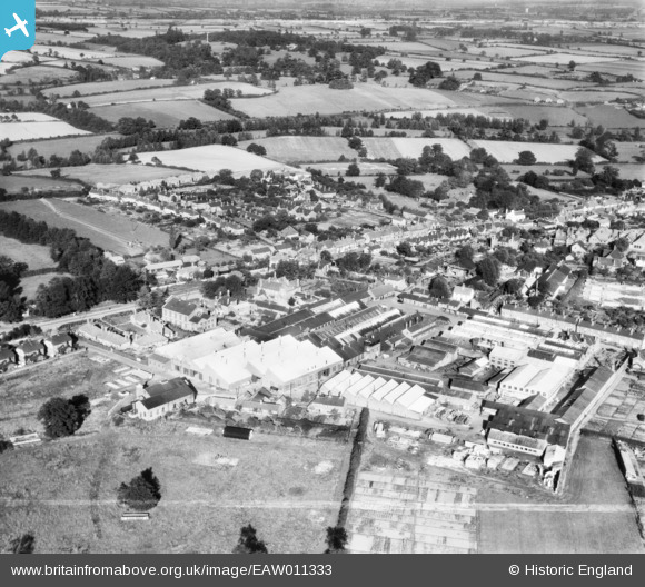
EAW011333 ENGLAND (1947). The Atlas Iron Works (Agricultural Implements), Earls Colne, 1947. This image was marked by Aerofilms Ltd for photo editing.
© Hawlfraint cyfranwyr OpenStreetMap a thrwyddedwyd gan yr OpenStreetMap Foundation. 2026. Trwyddedir y gartograffeg fel CC BY-SA.
Delweddau cyfagos (14)
EAW011333
, Earls Colne, 1947. This image was marked by Aerofilms Ltd for photo editing.")
EAW011329
, Earls Colne, from the south-west, 1947")
EAW011321
, Earls Colne, 1947. This image was marked by Aerofilms Ltd for photo editing.")
EAW011323
 and the village, Earls Colne, 1947. This image was marked by Aerofilms Ltd for photo editing.")
EAW011322
, Earls Colne, 1947. This image was marked by Aerofilms Ltd for photo editing.")
EAW011326
, Earls Colne, 1947. This image was marked by Aerofilms Ltd for photo editing.")
EAW011325
, Earls Colne, 1947. This image was marked by Aerofilms Ltd for photo editing.")
EAW011328
, Earls Colne, from the north-west, 1947. This image was marked by Aerofilms Ltd for photo editing.")
EAW011332
, Earls Colne, 1947. This image was marked by Aerofilms Ltd for photo editing.")
EAW011327
, Earls Colne, 1947. This image was marked by Aerofilms Ltd for photo editing.")
EAW011331
, Earls Colne, from the south-east, 1947. This image was marked by Aerofilms Ltd for photo editing.")
EAW011330
, Earls Colne, 1947. This image was marked by Aerofilms Ltd for photo editing.")
EAW011324
 and the village, Earls Colne, 1947. This image was marked by Aerofilms Ltd for photo editing.")
EAW043692

Manylion
| Pennawd | [EAW011333] The Atlas Iron Works (Agricultural Implements), Earls Colne, 1947. This image was marked by Aerofilms Ltd for photo editing. |
| Cyfeirnod | EAW011333 |
| Dyddiad | 1-October-1947 |
| Dolen | |
| Enw lle | EARLS COLNE |
| Plwyf | EARLS COLNE |
| Ardal | |
| Gwlad | ENGLAND |
| Dwyreiniad / Gogleddiad | 585384, 228781 |
| Hydred / Lledred | 0.69646642697528, 51.926196034129 |
| Cyfeirnod Grid Cenedlaethol | TL854288 |
Pinnau

Ferrers |
Sunday 18th of December 2022 12:27:45 PM | |

thomasmann |
Sunday 8th of June 2014 04:00:03 PM |