
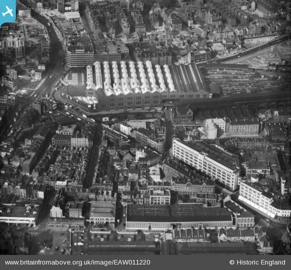
EAW011220 ENGLAND (1947). Bishopsgate Goods Station (Goods Yard), Commercial Street and environs, Spitalfields, 1947
© Hawlfraint cyfranwyr OpenStreetMap a thrwyddedwyd gan yr OpenStreetMap Foundation. 2026. Trwyddedir y gartograffeg fel CC BY-SA.
Delweddau cyfagos (9)
EAW011220
, Commercial Street and environs, Spitalfields, 1947")
EAW011140
 and environs, Shoreditch, 1947")
EAW011380

EAW011196
, Christ Church and environs, Spitalfields, 1947")
EAW011219

EPW036250

EAW011197

EAW011141

EAW011139

Manylion
| Pennawd | [EAW011220] Bishopsgate Goods Station (Goods Yard), Commercial Street and environs, Spitalfields, 1947 |
| Cyfeirnod | EAW011220 |
| Dyddiad | 30-September-1947 |
| Dolen | |
| Enw lle | SPITALFIELDS |
| Plwyf | |
| Ardal | |
| Gwlad | ENGLAND |
| Dwyreiniad / Gogleddiad | 533582, 182090 |
| Hydred / Lledred | -0.074371221056355, 51.521428303436 |
| Cyfeirnod Grid Cenedlaethol | TQ336821 |
Pinnau

James 1962 |
Saturday 11th of July 2026 04:55:12 PM | |
|
Dank |
Monday 12th of January 2026 07:41:02 PM | |
|
Dank |
Monday 12th of January 2026 07:38:00 PM | |
|
The Laird |
Tuesday 23rd of October 2018 12:36:06 AM | |

Class31 |
Wednesday 23rd of July 2014 02:49:55 PM | |
|
Class31 |
Wednesday 23rd of July 2014 02:49:22 PM | |
|
Class31 |
Monday 12th of May 2014 07:15:48 PM | |
|
glennhughz |
Thursday 10th of April 2014 03:58:20 PM |
Cyfraniadau Grŵp
View is looking north. |
Class31 |
Monday 12th of May 2014 07:16:08 PM |