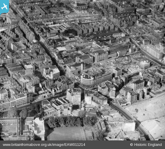
EAW011214 ENGLAND (1947). The junction of Goswell Road and Old Street with cleared site off Gee Street, St Luke's, 1947
    © Hawlfraint cyfranwyr OpenStreetMap a thrwyddedwyd gan yr OpenStreetMap Foundation. 2025. Trwyddedir y gartograffeg fel CC BY-SA.
  
Delweddau cyfagos (9)
Manylion
| Pennawd | [EAW011214] The junction of Goswell Road and Old Street with cleared site off Gee Street, St Luke's, 1947 | 
| Cyfeirnod | EAW011214 | 
| Dyddiad | 30-October-1947 | 
| Dolen | |
| Enw lle | ST LUKE'S | 
| Plwyf | |
| Ardal | |
| Gwlad | ENGLAND | 
| Dwyreiniad / Gogleddiad | 532016, 182264 | 
| Hydred / Lledred | -0.096866945079008, 51.523360397166 | 
| Cyfeirnod Grid Cenedlaethol | TQ320823 | 
Pinnau
|  Charterhouse Buildings |   Robin | Sunday 12th of September 2021 03:02:23 PM | 
| Class31 | Tuesday 8th of July 2014 07:25:55 PM | |
| Class31 | Tuesday 8th of July 2014 07:25:09 PM | |
| Class31 | Tuesday 8th of July 2014 07:24:11 PM | |
| Class31 | Tuesday 8th of July 2014 07:22:56 PM | |
| Class31 | Tuesday 8th of July 2014 07:22:02 PM | |
|  The Green | Class31 | Tuesday 8th of July 2014 07:19:22 PM | 
|  Clerkenwell Road | Class31 | Tuesday 8th of July 2014 07:18:38 PM | 
|  Goswell Road | Class31 | Tuesday 8th of July 2014 07:18:20 PM | 
|  Old Street | Class31 | Tuesday 8th of July 2014 07:17:46 PM | 
 
             
  ![[EAW011214] The junction of Goswell Road and Old Street with cleared site off Gee Street, St Luke's, 1947](http://britainfromabove.org.uk/sites/all/libraries/aerofilms-images/public/100x100/EAW/011/EAW011214.jpg) 
  
                                          ![[EAW011118] Old Street, the Peabody Estate and piles of rubble off Goswell Street following clearance of bomb damaged sites, St Luke's, 1947](http://britainfromabove.org.uk/sites/all/libraries/aerofilms-images/public/100x100/EAW/011/EAW011118.jpg) 
 ![[EAW011101] The Triangle, Percival Road and environs, St Luke's, 1947](http://britainfromabove.org.uk/sites/all/libraries/aerofilms-images/public/100x100/EAW/011/EAW011101.jpg) 
 ![[EAW011077] Goswell Road, King Square and environs, St Luke's, 1947](http://britainfromabove.org.uk/sites/all/libraries/aerofilms-images/public/100x100/EAW/011/EAW011077.jpg) 
 ![[EPW006001] Charterhouse, Islington, 1921. This image has been produced from a print.](http://britainfromabove.org.uk/sites/all/libraries/aerofilms-images/public/100x100/EPW/006/EPW006001.jpg) 
 ![[EAW011119] The Triangle, Seward Street and environs, St Luke's, 1947. This image has been produced from a print.](http://britainfromabove.org.uk/sites/all/libraries/aerofilms-images/public/100x100/EAW/011/EAW011119.jpg) 
 ![[EAW011215] St Luke's Church, Golden Lane and environs, St Luke's, 1947](http://britainfromabove.org.uk/sites/all/libraries/aerofilms-images/public/100x100/EAW/011/EAW011215.jpg) 
 ![[EAW011076] The area around Priestley House, St Luke's Church and environs, St Luke's, 1947](http://britainfromabove.org.uk/sites/all/libraries/aerofilms-images/public/100x100/EAW/011/EAW011076.jpg) 
 ![[EAW011202] Piles of rubble off Goswell Road from clearance of surrounding bomb damaged area, St Luke's, 1947](http://britainfromabove.org.uk/sites/all/libraries/aerofilms-images/public/100x100/EAW/011/EAW011202.jpg)