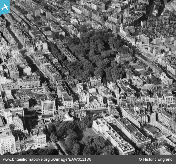
EAW011186 ENGLAND (1947). Gray's Inn and environs, Holborn, 1947
© Hawlfraint cyfranwyr OpenStreetMap a thrwyddedwyd gan yr OpenStreetMap Foundation. 2026. Trwyddedir y gartograffeg fel CC BY-SA.
Delweddau cyfagos (13)
Manylion
| Pennawd | [EAW011186] Gray's Inn and environs, Holborn, 1947 |
| Cyfeirnod | EAW011186 |
| Dyddiad | 30-September-1947 |
| Dolen | |
| Enw lle | HOLBORN |
| Plwyf | |
| Ardal | |
| Gwlad | ENGLAND |
| Dwyreiniad / Gogleddiad | 530922, 181721 |
| Hydred / Lledred | -0.11283051980647, 51.518734845861 |
| Cyfeirnod Grid Cenedlaethol | TQ309817 |
Pinnau

Shamus |
Monday 15th of December 2014 08:35:43 PM | |

billyfern |
Friday 3rd of October 2014 06:02:17 PM | |

billyfern |
Sunday 6th of July 2014 07:22:00 PM | |

billyfern |
Sunday 6th of July 2014 07:20:38 PM | |

billyfern |
Sunday 6th of July 2014 07:20:01 PM | |

billyfern |
Sunday 6th of July 2014 07:19:24 PM | |

billyfern |
Sunday 6th of July 2014 07:17:44 PM | |

billyfern |
Sunday 6th of July 2014 07:17:16 PM | |

billyfern |
Sunday 6th of July 2014 07:15:50 PM | |

billyfern |
Sunday 6th of July 2014 07:15:11 PM | |

Class31 |
Saturday 14th of June 2014 06:46:27 PM | |

Class31 |
Saturday 14th of June 2014 06:46:27 PM | |

Class31 |
Saturday 14th of June 2014 06:45:14 PM | |

Class31 |
Monday 12th of May 2014 04:25:48 PM | |

Alan McFaden |
Thursday 7th of November 2013 03:26:03 PM |


![[EAW011186] Gray's Inn and environs, Holborn, 1947](http://britainfromabove.org.uk/sites/all/libraries/aerofilms-images/public/100x100/EAW/011/EAW011186.jpg)
![[EAW018345] Gray's Inn Gardens and environs, Holborn, 1948. This image has been produced from a print.](http://britainfromabove.org.uk/sites/all/libraries/aerofilms-images/public/100x100/EAW/018/EAW018345.jpg)
![[EAW018344] High Holborn and environs, Holborn, 1948. This image has been produced from a print.](http://britainfromabove.org.uk/sites/all/libraries/aerofilms-images/public/100x100/EAW/018/EAW018344.jpg)
![[EPW005133] Gray's Inn and environs, London, 1920](http://britainfromabove.org.uk/sites/all/libraries/aerofilms-images/public/100x100/EPW/005/EPW005133.jpg)
![[EAW043626] High Holborn, Holborn and the surrounding city, London, from the east, 1952](http://britainfromabove.org.uk/sites/all/libraries/aerofilms-images/public/100x100/EAW/043/EAW043626.jpg)
![[EAW000619] Lincoln's Inn Fields and Gray's Inn Gardens, Holborn, 1946](http://britainfromabove.org.uk/sites/all/libraries/aerofilms-images/public/100x100/EAW/000/EAW000619.jpg)
![[EAW043628] Holborn, High Holborn and the surrounding city, Holborn, 1952](http://britainfromabove.org.uk/sites/all/libraries/aerofilms-images/public/100x100/EAW/043/EAW043628.jpg)
![[EAW010048] Holborn Bars, Gray's Inn and environs, Holborn, 1947. This image was marked by Aerofilms Ltd for photo editing.](http://britainfromabove.org.uk/sites/all/libraries/aerofilms-images/public/100x100/EAW/010/EAW010048.jpg)
![[EAW010068] High Holborn, Holborn Bar, Gray's Inn and environs, Holborn, 1947](http://britainfromabove.org.uk/sites/all/libraries/aerofilms-images/public/100x100/EAW/010/EAW010068.jpg)
![[EAW018346] Gray's Inn Road and environs, Holborn, 1948. This image has been produced from a print.](http://britainfromabove.org.uk/sites/all/libraries/aerofilms-images/public/100x100/EAW/018/EAW018346.jpg)
![[EAW011206] The Bourne Estate and environs, Holborn, 1947](http://britainfromabove.org.uk/sites/all/libraries/aerofilms-images/public/100x100/EAW/011/EAW011206.jpg)
![[EAW043629] Holborn, High Holborn, Lincoln's Inn Fields and the surrounding city, London, 1952](http://britainfromabove.org.uk/sites/all/libraries/aerofilms-images/public/100x100/EAW/043/EAW043629.jpg)
![[EAW011089] High Holborn and Lincoln's Inn Fields, Holborn, 1947](http://britainfromabove.org.uk/sites/all/libraries/aerofilms-images/public/100x100/EAW/011/EAW011089.jpg)
