
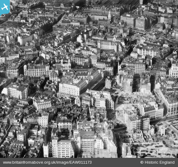
EAW011173 ENGLAND (1947). The Lloyd's Building on Lime Street and cleared sites around Fenchurch Avenue following bomb damage, London, 1947
© Hawlfraint cyfranwyr OpenStreetMap a thrwyddedwyd gan yr OpenStreetMap Foundation. 2026. Trwyddedir y gartograffeg fel CC BY-SA.
Delweddau cyfagos (20)
EAW011173

EAW035193

EAW035190

EAW035194

EAW035192

EAW035191

EAW035196

EAW004896

EAW035195

EAW035197

EAW035189

EAW011133

EAW011134

EAW000510

EAW004897

EAW011174

EAW035188

EPW057040

EAW011375

EAW011172

Manylion
| Pennawd | [EAW011173] The Lloyd's Building on Lime Street and cleared sites around Fenchurch Avenue following bomb damage, London, 1947 |
| Cyfeirnod | EAW011173 |
| Dyddiad | 30-September-1947 |
| Dolen | |
| Enw lle | LONDON |
| Plwyf | |
| Ardal | |
| Gwlad | ENGLAND |
| Dwyreiniad / Gogleddiad | 533190, 181086 |
| Hydred / Lledred | -0.080398098189926, 51.512497516668 |
| Cyfeirnod Grid Cenedlaethol | TQ332811 |
Pinnau

Cyfraniadau Grŵp
View is looking north. |

Class31 |
Monday 12th of May 2014 03:56:43 PM |