
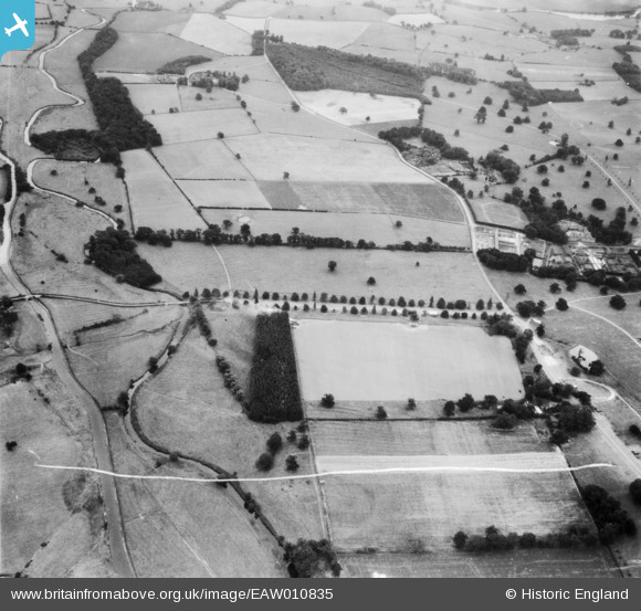
EAW010835 ENGLAND (1947). Trent Walk, Alder Coppice and surrounding countryside, Ingestre, 1947. This image was marked by Aerofilms Ltd for photo editing.
© Hawlfraint cyfranwyr OpenStreetMap a thrwyddedwyd gan yr OpenStreetMap Foundation. 2026. Trwyddedir y gartograffeg fel CC BY-SA.
Delweddau cyfagos (3)
EAW010835

EAW010836

EAW010838

Manylion
| Pennawd | [EAW010835] Trent Walk, Alder Coppice and surrounding countryside, Ingestre, 1947. This image was marked by Aerofilms Ltd for photo editing. |
| Cyfeirnod | EAW010835 |
| Dyddiad | 13-September-1947 |
| Dolen | |
| Enw lle | INGESTRE |
| Plwyf | INGESTRE |
| Ardal | |
| Gwlad | ENGLAND |
| Dwyreiniad / Gogleddiad | 398147, 325218 |
| Hydred / Lledred | -2.0275022857587, 52.824160476608 |
| Cyfeirnod Grid Cenedlaethol | SJ981252 |
Pinnau
Byddwch y cyntaf i ychwanegu sylw at y ddelwedd hon!
Cyfraniadau Grŵp

This shows the Trent Walk avenue of trees leading up to Ingestre Hall and the Orangery. |

Gill Broadbent |
Wednesday 2nd of July 2014 10:48:52 AM |