
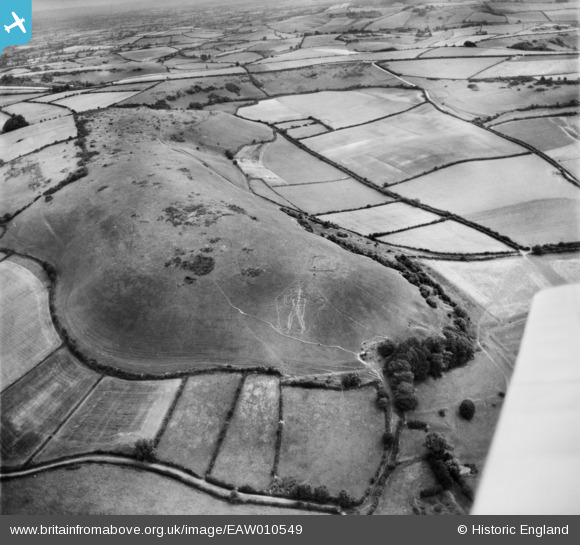
EAW010549 ENGLAND (1947). The Cerne Abbas Giant and Giant Hill, Cerne Abbas, 1947
© Hawlfraint cyfranwyr OpenStreetMap a thrwyddedwyd gan yr OpenStreetMap Foundation. 2026. Trwyddedir y gartograffeg fel CC BY-SA.
Delweddau cyfagos (3)
EAW010549

EAW003577

EAW004894

Manylion
| Pennawd | [EAW010549] The Cerne Abbas Giant and Giant Hill, Cerne Abbas, 1947 |
| Cyfeirnod | EAW010549 |
| Dyddiad | 30-August-1947 |
| Dolen | |
| Enw lle | CERNE ABBAS |
| Plwyf | CERNE ABBAS |
| Ardal | |
| Gwlad | ENGLAND |
| Dwyreiniad / Gogleddiad | 366788, 101769 |
| Hydred / Lledred | -2.4714738300013, 50.81395347461 |
| Cyfeirnod Grid Cenedlaethol | ST668018 |
Pinnau
Byddwch y cyntaf i ychwanegu sylw at y ddelwedd hon!