
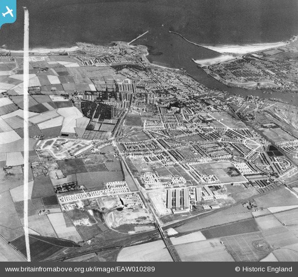
EAW010289 ENGLAND (1947). Development around West Chirton and Billy Mill, West Chirton, from the west, 1947. This image was marked by Aerofilms Ltd for photo editing.
© Hawlfraint cyfranwyr OpenStreetMap a thrwyddedwyd gan yr OpenStreetMap Foundation. 2026. Trwyddedir y gartograffeg fel CC BY-SA.
Delweddau cyfagos (3)
EAW010289

EAW010278

EAW010279

Manylion
| Pennawd | [EAW010289] Development around West Chirton and Billy Mill, West Chirton, from the west, 1947. This image was marked by Aerofilms Ltd for photo editing. |
| Cyfeirnod | EAW010289 |
| Dyddiad | 24-August-1947 |
| Dolen | |
| Enw lle | WEST CHIRTON |
| Plwyf | |
| Ardal | |
| Gwlad | ENGLAND |
| Dwyreiniad / Gogleddiad | 432754, 568567 |
| Hydred / Lledred | -1.4877812417286, 55.010509986589 |
| Cyfeirnod Grid Cenedlaethol | NZ328686 |
Pinnau
Byddwch y cyntaf i ychwanegu sylw at y ddelwedd hon!