
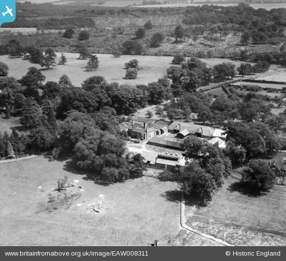
EAW008311 ENGLAND (1947). Home Farm, Woodstock, 1947
© Hawlfraint cyfranwyr OpenStreetMap a thrwyddedwyd gan yr OpenStreetMap Foundation. 2026. Trwyddedir y gartograffeg fel CC BY-SA.
Delweddau cyfagos (9)
EAW008311

EAW008313

EAW008308

EAW008310

EAW008295

EAW008298

EAW008299

EAW008297

EAW008302

Manylion
| Pennawd | [EAW008311] Home Farm, Woodstock, 1947 |
| Cyfeirnod | EAW008311 |
| Dyddiad | 15-July-1947 |
| Dolen | |
| Enw lle | WOODSTOCK |
| Plwyf | TUNSTALL |
| Ardal | |
| Gwlad | ENGLAND |
| Dwyreiniad / Gogleddiad | 590139, 160737 |
| Hydred / Lledred | 0.72861392808229, 51.313422399609 |
| Cyfeirnod Grid Cenedlaethol | TQ901607 |
Pinnau
Cyfraniadau Grŵp
Thanks for looking at these, it's a great help. We'll update the catalogue and post the new data here in due course. Yours, Katy Britain from Above Cataloguing Team Leader |
Katy Whitaker |
Tuesday 7th of January 2014 01:18:32 PM |
In the set EAW008294, EAW008296 - EAW008308, EAW008310 - EAW008311, EAW008313. All taken in same area with oast houses and orchards. Kent? |

Rebecca |
Monday 4th of November 2013 02:04:39 PM |