
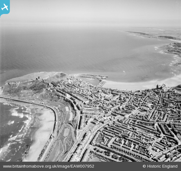
EAW007952 ENGLAND (1947). South Bay and the headland, Scarborough, from the north-west, 1947
© Hawlfraint cyfranwyr OpenStreetMap a thrwyddedwyd gan yr OpenStreetMap Foundation. 2026. Trwyddedir y gartograffeg fel CC BY-SA.
Delweddau cyfagos (3)
EAW007952

EAW007951

EPW029092

Manylion
| Pennawd | [EAW007952] South Bay and the headland, Scarborough, from the north-west, 1947 |
| Cyfeirnod | EAW007952 |
| Dyddiad | 26-June-1947 |
| Dolen | |
| Enw lle | SCARBOROUGH |
| Plwyf | |
| Ardal | |
| Gwlad | ENGLAND |
| Dwyreiniad / Gogleddiad | 504247, 489130 |
| Hydred / Lledred | -0.398389657537, 54.286994875346 |
| Cyfeirnod Grid Cenedlaethol | TA042891 |
Pinnau

garfield70 |
Sunday 28th of June 2020 06:25:12 PM | |
|
redmist |
Thursday 12th of September 2019 08:26:10 PM | |
|
redmist |
Thursday 12th of September 2019 08:43:11 AM | |
|
redmist |
Thursday 12th of September 2019 08:42:26 AM | |

Mullenaround |
Monday 12th of March 2018 02:07:33 PM | |
|
CartoonHead |
Tuesday 23rd of January 2018 08:59:23 PM |
