
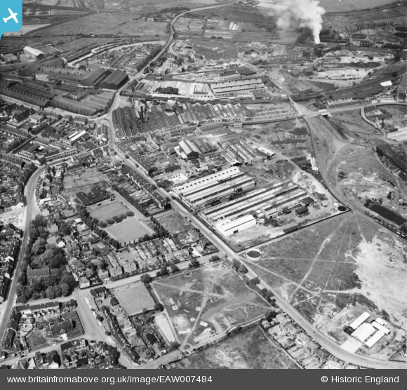
EAW007484 ENGLAND (1947). The Charles Richards and Sons Nut and Bolt Works, Owen Park and the surrounding industrial area, Darlaston Green, 1947
© Hawlfraint cyfranwyr OpenStreetMap a thrwyddedwyd gan yr OpenStreetMap Foundation. 2026. Trwyddedir y gartograffeg fel CC BY-SA.
Delweddau cyfagos (23)
EAW007484

EAW007490

EPW046098

EAW007492

EPW046093

EPW046097

EPW046095

EAW007494

EAW007485

EPW046099

EAW007486

EAW007488

EAW007493

EAW007487

EAW007489

EPW046091

EPW046096

EPW046092

EAW007491

EPW046094

EPW046087

EPW046088

EPW046089

Manylion
| Pennawd | [EAW007484] The Charles Richards and Sons Nut and Bolt Works, Owen Park and the surrounding industrial area, Darlaston Green, 1947 |
| Cyfeirnod | EAW007484 |
| Dyddiad | 3-June-1947 |
| Dolen | |
| Enw lle | DARLASTON GREEN |
| Plwyf | |
| Ardal | |
| Gwlad | ENGLAND |
| Dwyreiniad / Gogleddiad | 397983, 297444 |
| Hydred / Lledred | -2.0297660250884, 52.57445294321 |
| Cyfeirnod Grid Cenedlaethol | SO980974 |
Pinnau

Matt Aldred edob.mattaldred.com |
Thursday 8th of May 2025 03:58:07 PM | |
|
Matt Aldred edob.mattaldred.com |
Wednesday 9th of April 2025 04:35:48 PM | |

Andy B |
Tuesday 18th of August 2020 01:27:30 PM | |
|
KevTheBusDriver |
Sunday 28th of June 2015 07:02:45 PM | |
|
KevTheBusDriver |
Sunday 28th of June 2015 07:01:05 PM | |
|
PaulEdwards |
Wednesday 17th of June 2015 06:39:39 PM | |
|
PaulEdwards |
Wednesday 17th of June 2015 06:38:48 PM |